Conservation and Management of the Endangered Wild Cattle, Bos javanicus lowi, in Sabah
About
PhD researcher: Penny Gardner
MSc researcher: Hong Ye Lim @ Hugo
Sponsors: Yayasan Sime Darby, Houston Zoo
Counterpart: Sabah Wildlife Department
Collaborators: Sabah Forestry Department
Duration: 2012-2017
Aims:
To collect baseline data on banteng demography, activity patterns, home-range size and population structure, locate the remaining subpopulations of banteng across the state of Sabah and assess their conservation status and longevity in their current locations.
Summary:
The first state-wide survey of the Bornean banteng in Sabah was conducted in 1982 by Davies and Payne, which used non-quantitative community-based surveys to collect information on sightings from villagers in order to identify and map the distribution of banteng subpopulations. A second survey was conducted by Boonratana in 1996, which used non-invasive surveys of banteng tracks and dung deposits to identify their distribution and estimate density. Since this time, dramatic changes to the landscape have occurred, with widespread deforestation and conversion of banteng habitat to vast agricultural plantations. This activity has had a detrimental impact on the banteng, causing local extinctions of subpopulations and advancing the declining trend of this species. The present-day distribution of banteng in Sabah is unknown. Therefore, it is very difficult to a) effectively manage the population, b) identify priority subpopulations for conservation, and c) design, implement and monitor appropriate conservation strategies to prevent their impending extinction.
Methods:
Training of students and staff was conducted in non-invasive sampling of faecal DNA, camera trapping, recognition of signs, navigation and data management to facilitate research. Temporary staff and those from other organisations also received training in banteng camera trapping and navigation when required. These skills were used to further their career progression and facilitate banteng conservation. One international student has been educated to PhD level in banteng ecology and population genetics. One local MSc student focused his research project on banteng distribution modelling. Four international undergraduate PTY students gained one year’s experience in banteng research and conservation, and each produced a small research project on banteng ecology. Another two undergraduate students joined in 2015. The findings of these research projects have been incorporated into reports specifically written for each forest surveyed and have contributed towards the drafting of the State Action Plan for banteng in Sabah.
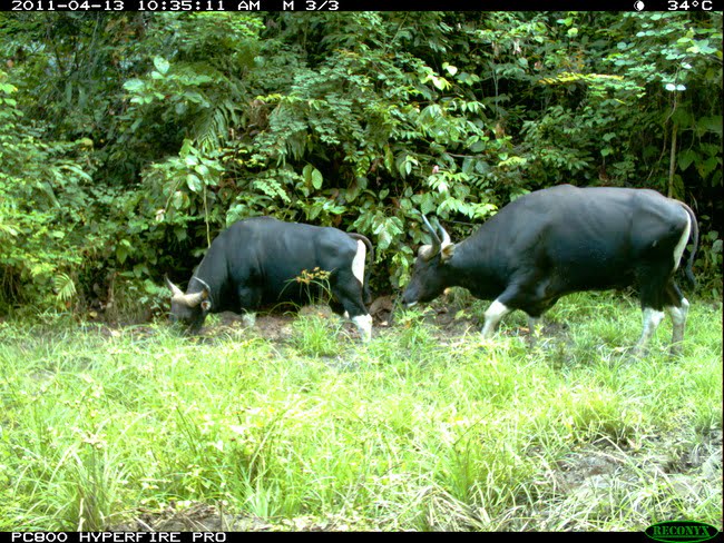
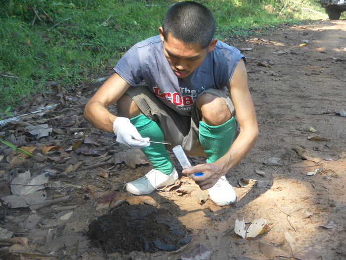
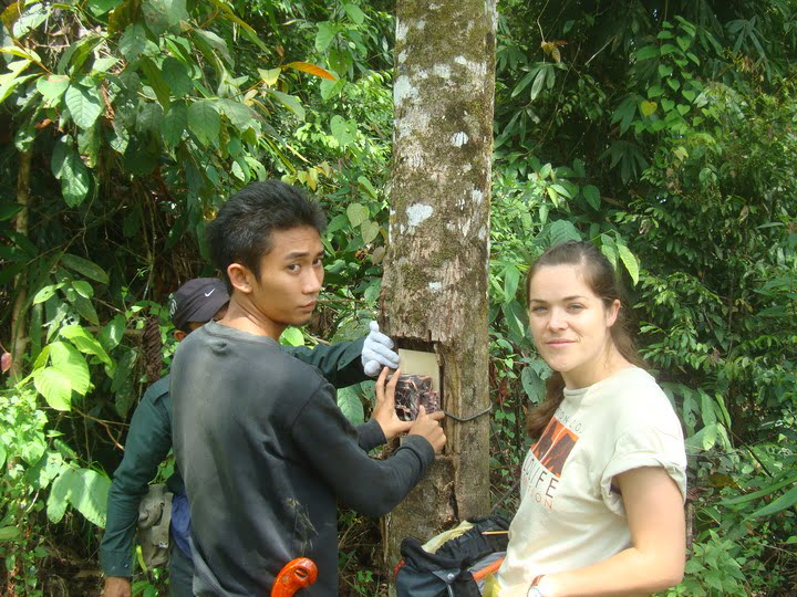
Remnant subpopulations have been located using remote infrared Reconyx camera traps, sign encounters and ad-hoc sightings whilst data is compiled from other stakeholders and researchers. The preliminary distribution of banteng has been mapped using the digital mapping software ArcGIS. Baseline data on herd demography, activity patterns, and illegal activity has been collected using remote infrared camera traps and direct observation and analysed using the same methods developed in Project 1. The population genetic structure has been identified using non-invasively collected faecal DNA and amplified using mitochondrial markers developed during Project 1.
Banteng signs and observations will be modelled using distribution modelling algorithms to identify unoccupied habitats that may have the potential to support banteng and to identify wildlife corridors to re-establish connectivity between banteng subpopulations. The distribution of illegal activity will show the areas of the forest reserves that are most vulnerable and which subpopulations should be the conservation priority.
A workshop held in 2017 has provided a platform for information-sharing and conducting a population and habitat viability analysis, which has been fed into the Action Plan for banteng in Sabah.

wild cattle Bos javanicus lowi©DGFC

Collecting faecal DNA©DGFC

Camera trapping©DGFC

